

Primary market
Wind Energy Aerial Inspections
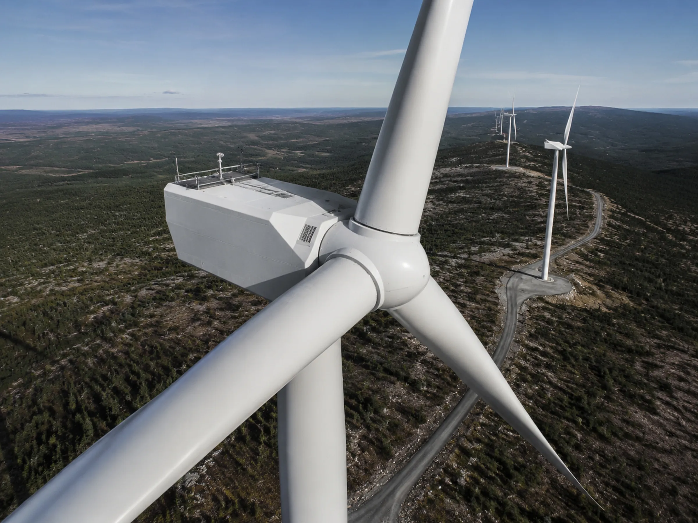
Exterior visual documentation of turbines and supporting infrastructure, captured to a planned pattern.
Overview
Turbine exteriors are difficult and costly to reach. Aerial capture provides a documented visual record of external condition without putting a technician on the structure for a first look.
Vertex flies planned capture patterns around turbines and associated site infrastructure, producing organized imagery your technical team or a qualified specialist can review.
Scope and deliverables
What we capture
- Exterior visual documentation of turbine towers, nacelles, and blade surfaces as viewable from the air
- Planned image capture patterns for condition review
- Documentation of pad, foundation, transformer, and surrounding site conditions
- Site and access documentation ahead of maintenance mobilization
- Repeatable capture so later flights can be compared with earlier ones
What you receive
- Organized exterior image sets per turbine
- Position-labeled captures where the workflow supports it
- Video documentation where requested
- Site and access condition imagery
- Folder structures aligned to your turbine identifiers
Scope boundaries
What this service does not include
Being precise about the edges of our scope is part of doing this work properly. These are the limits of what Vertex provides on this service.
- Vertex holds no GWO certification and does not perform rope-access or technician-at-height work.
- We do not perform blade non-destructive testing, internal blade inspection, or any internal component inspection.
- We do not provide engineering conclusions, structural assessments, or repair recommendations.
- We do not run proprietary or automated defect-analytics software.
- Capture is exterior and visual. Interpretation is performed by your qualified personnel or a specialist of your choosing.
How a project runs
From defined scope to reviewable data
Every engagement follows the same sequence, so you know what happens before, during, and after the flight.
-
Project scope and deliverables
We agree what the asset is, what needs documenting, and exactly which outputs you receive. Scope is defined before anything is flown.
-
Airspace, site, access, and mission planning
Airspace is checked and authorizations obtained where required. Site access, hazards, and the capture pattern are planned in advance.
-
RGB, thermal, video, or mapping-oriented capture
Missions are flown to the agreed pattern. Thermal capture is scheduled for conditions that make it useful rather than simply convenient.
-
File organization and quality review
Imagery is checked for coverage and usability, then organized into a folder structure that matches how your team refers to the asset.
-
Delivery for client or specialist analysis
Organized data is delivered for review by your team, your contractor, your insurer, or a qualified specialist.
Related capabilities
-
Utility-Scale Solar Inspections
RGB and thermal aerial capture across large PV sites, organized for operations and maintenance review.
-
Commercial and Industrial Site Inspections
Exterior asset documentation across commercial property and industrial facilities.
-
Professional Aerial Photography and Video
Aerial photography and video for commercial sites, developments, and facilities.
Request a project review
Tell us what needs documenting and we will confirm whether aerial capture is the right approach, what it would cover, and what you would receive.
Useful details to include
- Asset or project type
- Site location
- Approximate site size or number of assets
- Required outputs
- Desired schedule
- Site access conditions