

Construction and spatial documentation
Construction Progress Monitoring
Scheduled, repeatable progress capture from consistent viewpoints across the project lifecycle.
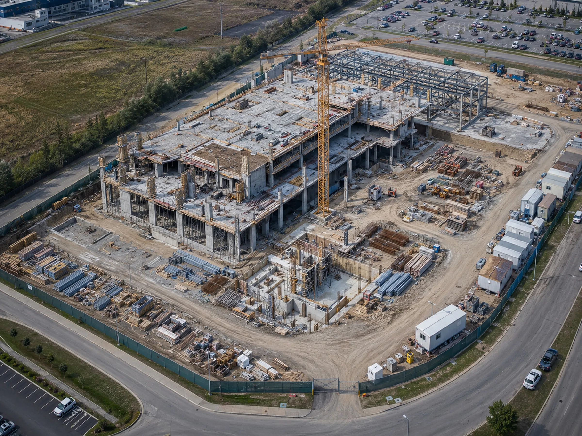
Overview
Progress disputes and remote-stakeholder questions come down to the same thing: what did the site look like, and when. Scheduled aerial capture from consistent viewpoints answers that without anyone flying in.
Vertex captures projects on an agreed interval, returning to the same positions each visit so images compare cleanly across the build.
Scope and deliverables
What we capture
- Repeatable progress photography from consistent, planned viewpoints
- Milestone documentation at agreed project stages
- Full-site overview capture alongside targeted area detail
- Scheduled recurring capture — weekly, monthly, or milestone-based
- Mapping-oriented capture where the selected workflow supports it
What you receive
- Date-organized image sets from matched viewpoints
- Full-site overview imagery per visit
- Video documentation where requested
- Stakeholder-ready visual records
- Consistent folder structure across the project timeline
Scope boundaries
What this service does not include
Being precise about the edges of our scope is part of doing this work properly. These are the limits of what Vertex provides on this service.
- Vertex documents observable site conditions. We do not verify quantities, schedule compliance, or contract performance.
- We do not provide construction administration, inspection sign-off, or code-compliance determinations.
- Volumetric or measurement outputs are only available when the agreed workflow supports them, and are never survey-grade.
How a project runs
From defined scope to reviewable data
Every engagement follows the same sequence, so you know what happens before, during, and after the flight.
-
Project scope and deliverables
We agree what the asset is, what needs documenting, and exactly which outputs you receive. Scope is defined before anything is flown.
-
Airspace, site, access, and mission planning
Airspace is checked and authorizations obtained where required. Site access, hazards, and the capture pattern are planned in advance.
-
RGB, thermal, video, or mapping-oriented capture
Missions are flown to the agreed pattern. Thermal capture is scheduled for conditions that make it useful rather than simply convenient.
-
File organization and quality review
Imagery is checked for coverage and usability, then organized into a folder structure that matches how your team refers to the asset.
-
Delivery for client or specialist analysis
Organized data is delivered for review by your team, your contractor, your insurer, or a qualified specialist.
Related capabilities
-
Aerial Mapping and 3D Documentation
Orthomosaic-oriented capture, site models, and spatial documentation for planning and coordination.
-
Commercial and Industrial Site Inspections
Exterior asset documentation across commercial property and industrial facilities.
-
Professional Aerial Photography and Video
Aerial photography and video for commercial sites, developments, and facilities.
Request a project review
Tell us what needs documenting and we will confirm whether aerial capture is the right approach, what it would cover, and what you would receive.
Useful details to include
- Asset or project type
- Site location
- Approximate site size or number of assets
- Required outputs
- Desired schedule
- Site access conditions